The Alpine Biome
Alpine biomes by their nature do not fit into a simple climatic scheme. In general, as one ascends a mountain, temperature drops by about 10° C for every 1000 meters in altitude gained (a suspiciously round number!). This means that if you start at sea level at 30° C and go up 1,000 meters the temperature will be 20° C; at the top of a 3,000 meter mountain the temperature will be 0° C. This the only thing you can say about the climate in alpine regions is that it is colder than one would expect at sea level at the same latitude. Rainfall also varies considerably; as the rising air cools it loses the ability to retain moisture and clouds form, with the result of increasing precipitation on the side of a mountain exposed to winds. On the other side, the descending air (already dried by its trip over the mountains) warms and removes moisture from the ground - this is one of the driving forces behind the deserts in the American Southwest.
In these web pages the alpine "biome" will be considered to be the upper altitudes of mountains, where cooler climates give rise to communities which resemble (but do not duplicate) the taiga, tundra and ice biomes.
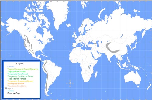
As you can see on the map above, alpine conditions are found in the great mountain ranges of the world. The map above is somewhat parochial as the author is more familiar with the mountains in the American west than in other parts of the world. Still, the global mountain ranges that are parts of the alpine biome include the Rockies, Sierra, and Cascade mountains in North America, the Andes in South America, the Himalayas in Asia, the Alps and Pyrenees in Europe, and the Rift Mountains of Africa. There are other mountain regions to be sure, but they are not shown on the map above either because they are too small to show up at this resolution, are too low to support tundra or ice conditions, or occur so far north that they are effectively subsumed into the rock and ice or tundra biomes. You might want to explore mountain ranges further at this site:
Most of the mountain ranges are associated, of course, with plate tectonics.
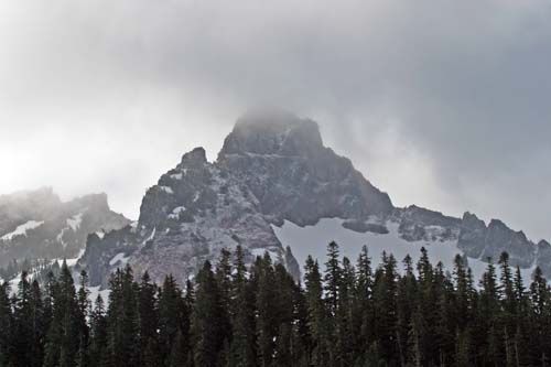
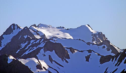
Near Mt. Rainier, Washington |
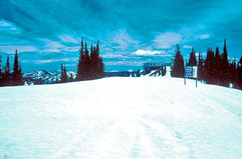
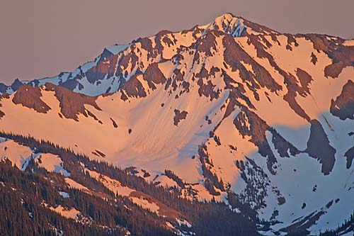
Big Mountain, Montana |
|
|
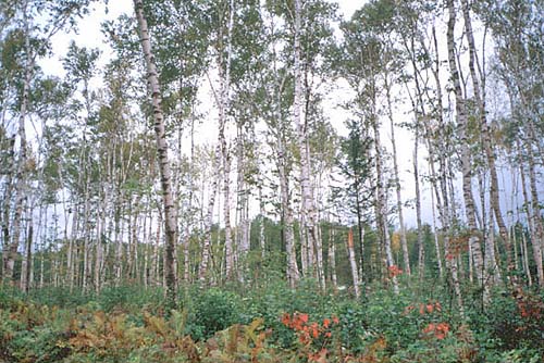
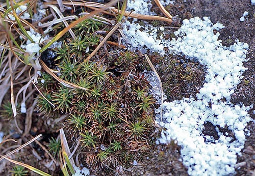
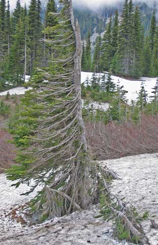
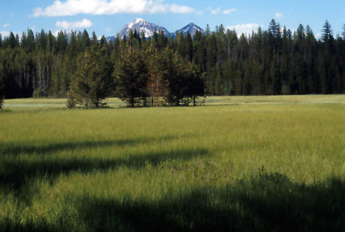
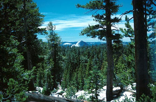
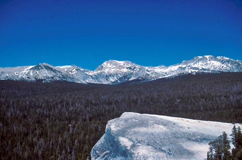
Alpine habitats encompass a wide variety, as seen in these images. Above, a rocky spire has little soil to support tree life; what little soil is formed in freeze-thaw cycles quickly drops off the sheer rock face. In contrast, the gentler slope of the summit of Big Mountain in Montana would probably support trees had they not been cleared for a ski facility. In Yosemite National Park (right) the granite of Half-Dome sticks out above the coniferous forests, which themselves are patchy on the very rocky ground. Below, a view from a high vantage point in Yosemite shows a more continuous coniferous forest lapping up to the steep (and high) slopes of the surrounding Sierra Nevada mountains. These high slopes - either because they are too steep; too rocky; or too cold, windswept and dry - exhibit a definite treeline above which no trees grow. To the right, below, steep slopes of talus (big chunks) and scree (small chunks) line a canyon gouged by glacial action and meltwater. Clearly the elevation here is not the issue for the trees as they are bountiful at the altitude from whence the picture was taken; rather, stability of the slopes may be the factor preventing tree growth. |
Yosemite National Park |
|
Yosemite National Park |
Near Mt. Rainier, Washington |
|
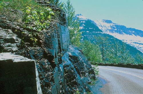
Glacier National Park |
Glacier National Park |
|
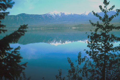
MacDonald Lake, Glacier National Park |
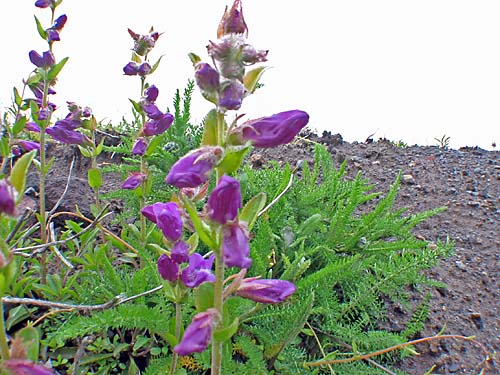
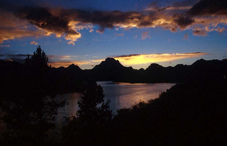
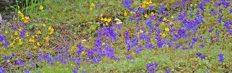
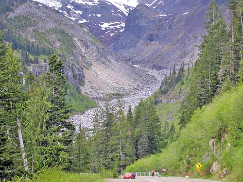
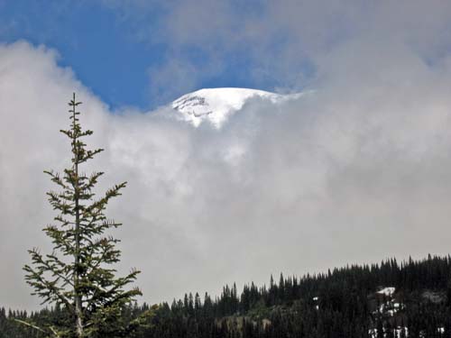
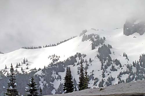
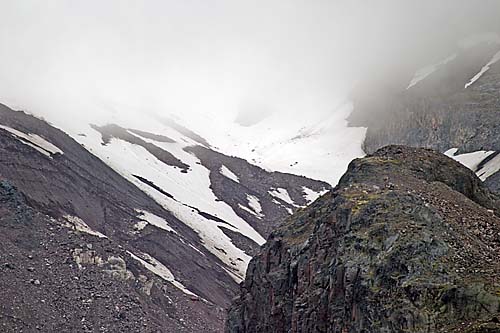
High mountains (above) may be perpetually covered with snow and ice (and glaciers) throughout the year and thus resemble the arctic. Global warming may be changing this, however, as the glaciers begin to melt and retreat (above left). The mountains in the photo to the left show snow only at the peaks; this picture was taken in June at a time when traditionally the snowline on the mountains was lower. In the lower left photo wildflowers typical of an alpine tundra Johnston Ridge across from Mt. St. Helens; it would be tempting to conclude that at this altitude such a tundra-like habitat was the norm - until one realized that this ridge was covered by a coniferous forest until the 1980 eruption. As of the time this photo was taken in 2004, the forest had not been able to regenerate. Below, the Appalachian Mountains rarely peak high enough to show a treeline, but they do bring taiga-like plant and animal species down into lower latitudes than they normally would be seen. During past periods of glaciation, northern species were common much further south - as the glaciers retreated, the northern species moved back north with the glaciers, although some were able to persist at the higher elevations in the mountains. |
|
|
|
||
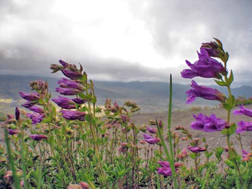
Wildflowers, Mt. St. Helens |
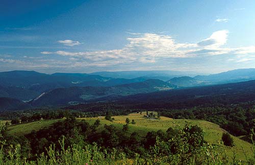
Appalachian Mountains, West Virginia |
|
|
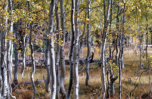
Aspens Above: Aspens are often found in the zone where deciduous trees transition into conifers in the mountains. If you are hiking up a mountain in the west, the sight of aspens is a sign that the coniferous forest will start soon. Below: A mountain meadow in Glacier National Park. Such open areas may appear for several reasons - fires, avalanches, storms, wetlands, serpentine soils, etc. may all contribute to the development of grassy areas without trees.
Mountain Meadow, Glacier National Park
|
||
Olympic Mountains, Olympic Peninsula, Washington |
Olympic Mountains, Olympic Peninsula, Washington |
|
|
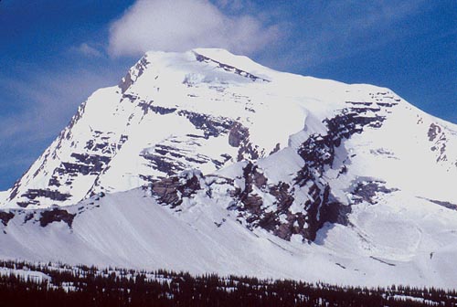
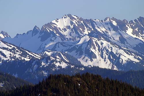
These views show some of the higher peaks in the Olympic Range on the Olympic Peninsula of Washington State. Snow and ice sculpt the high elevations of these relatively young mountains. Below, snow and ice are still actively sculpting Mt. Rainier, a dormant volcano looming over the city of Seattle. |
Olympic Mountains, Olympic Peninsula, Washington |
|
Mt. Rainier, Washington |
Mt. Rainier, Washington |
|
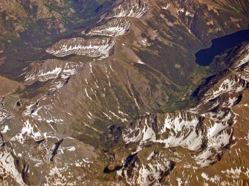
Rocky Mountains, Colorado |
Mt. Rainier, Washington |
|
Rocky Mountains, Montana |
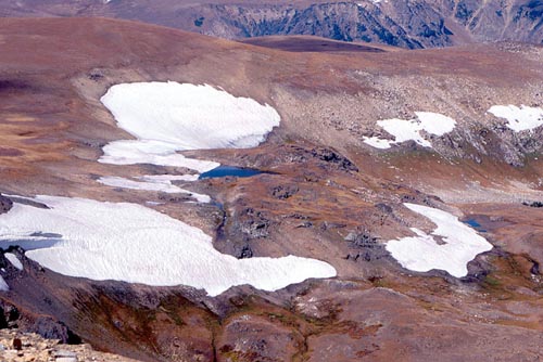
In these photos one catches a glimpse of the role of snow and ice in the mountains. The aerial view above left is of the Rocky Mountains in Colorado. This picture is disturbing as it was taken in early June, 2004, a time when one would expect to see a much greater snow pack. The snow pack, as it gradually melts over the course of the summer, supplies fresh water to the aquatic ecosystems of the mountains - and to the deserts and cities beyond. A thin snow pack will not provide enough water, and a snow pack that melts too quickly will overwhelm storage structures such as dams and leave the rivers dry in the later summer. The skimpy snow pack seen here is the result of a long-term western drought and the effects of global warming. Above right and to the left: At a closer approach, one can see how the melting snow fills rivers and even small cirque lakes carved out of the mountainsides by mini-glaciers. These small lakes (left) are a unique alpine habitat. Below left, snowpoles about 15 feet high illustrate how thick the snow pack may be at the end of winter, instead of the beginning of winter, such as the September day this photo was taken. These poles just outside of Yellowstone National Park will help the crews find and open the road the next June. Below, mountains make their own weather. As air is pushed over this high peak north of Vancouver, British Columbia it cools; the water in it condenses, and a snowstorm erupts in June. |
|
Rocky Mountains, Montana |
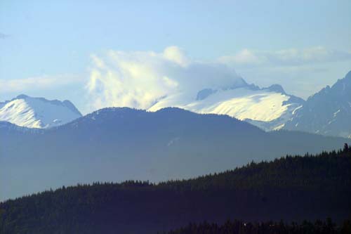
Cascade Range, near Vancouver, British Columbia |
|
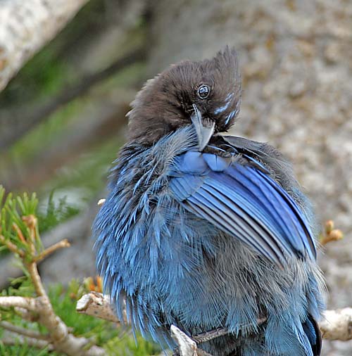
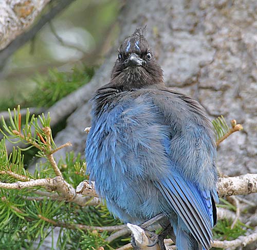
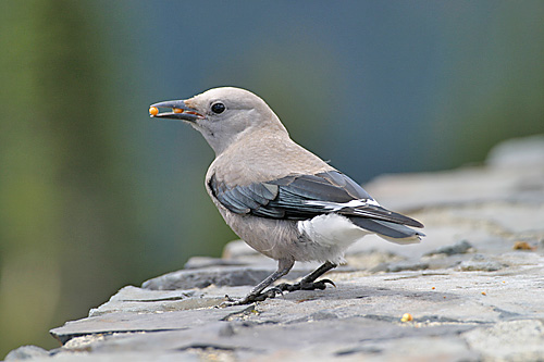
Steller's Jay, Cyanocitta stelleri, Mt. Rainier |
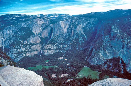
Yosemite Valley, Yosemite National Park Above - the incredible Yosemite Valley, scooped out of the granite bedrock by a glacier, leaving streams hanging to fall thousands of feet in spectacular waterfalls. |
|
|
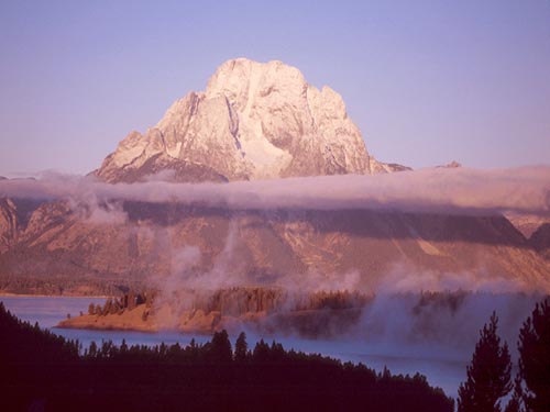
Grand Teton Mountains, Wyoming |
||